- Orinoco Subregion · Southern Anzoátegui · Venezuela
Territory
Territory and municipalities
The Orinoco Subregion lies at the far south of Anzoátegui State, directly on the Orinoco River. The territorial profile identifies its general boundaries as the Orinoco River to the south, Guárico State to the west, Monagas State to the east and central-southern Anzoátegui to the north.
Strategic location
Three reasons behind a geo-economic position
It opens up options for freight transport, links between production areas and interregional trade.
Links with the corridors of southern and central-southern Anzoátegui and with Bolívar State, via the Angostura and Orinoquia bridges.
Natural resources, rural communities, urban centers, productive activity and potential sites for industrial and logistics infrastructure, side by side.
- Reference area
The economic profile (20/10/2026) gives a reference territory of about 8,000 km². The area must be confirmed with official mapping.
Hover over or tap the globe to zoom in on the subregion
Reference boundaries, not official: state from Natural Earth (public domain); municipalities from C. E. Porto Tapiquén (2015) via geoBoundaries (ODbL 1.0); Orinoco River from Natural Earth.
- Orinoco Subregion (approximate reference)
Municipalities
Development tailored to each municipality
The three municipalities share a geographic setting, but not necessarily the same strengths, infrastructure or investment conditions.
Independencia
Industrial, river, forestry and services platform
- Macapaima
- Wood processing
- Logistics and warehousing
- Industrial services
- Agribusiness
José Gregorio Monagas
Farming, forestry and fishing, and services linked to the energy sector
- Agribusiness
- Dairy
- Fishing
- Forest products processing
- Maintenance and logistics support
Francisco de Miranda
Farming, livestock, food processing and rural production services
- Meat and milk processing
- Crop collection
- Cold chain
- Food manufacturing
- Producer services
- Initial specialization proposal
This breakdown is an initial specialization proposal, not a final allocation of projects nor a claim that all facilities are available. It must be validated through an asset survey, consultations with businesses and an assessment of each locality’s comparative advantages.
Road and river connectivity
Corridors and access routes
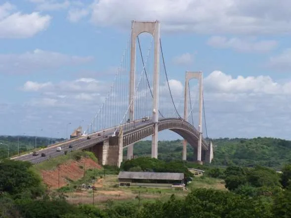
El Tigre – Ciudad Orinoco – Ciudad Bolívar corridor
Linked to Trunk Road 16 and the Angostura Bridge. A strategic road link for moving people, equipment, goods and regional production.
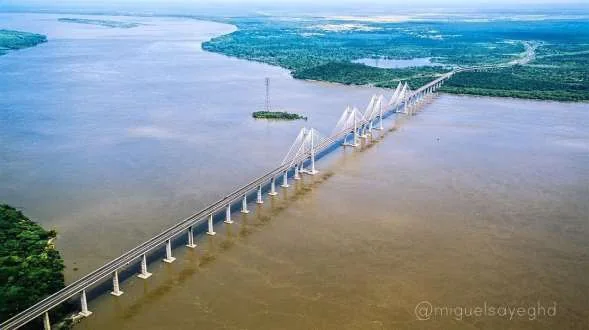
El Tigre – Palital – Puerto Ordaz corridor
Associated with access via the Independencia–Palital interchange and the Orinoquia Bridge. It can support commercial and industrial integration with Bolívar State.
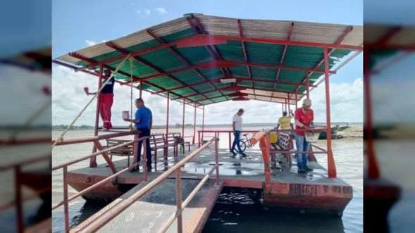
River access points at Ciudad Orinoco and Macapaima
The profile mentions the Tamarindo ramp and small artisanal jetties as references for assessing storage, river transport and logistics facilities.
Farming and livestock routes
- Ciudad Orinoco – Mamo Arriba
- Ciudad Orinoco – Caramacate
- La Fundación – Juan Pedro el Remanso
- San Diego de Cabrutica – Mapire
- Los Avestruces – El Cari
- El Tigre – Uverito
- Múcura – El Palmar del Orinoco
Internal road shortfall
The profile itself warns of a shortfall in internal road infrastructure, which makes moving goods and people more expensive. This limitation is acknowledged openly and the proposal is to make it a priority: the Productive Connectivity Program (road maintenance, drainage, bridges, industrial access, digital connectivity, cargo transfer and a technical assessment of the jetties).
The Orinoco
A logistics and trade asset still to be built
The Orinoco River is a strategic asset for the regional economy. The opportunity is not to claim that an international-scale port platform already exists, but to build up the conditions to develop one step by step: navigation studies, draft depths, hydrological analysis, berthing infrastructure, cargo yards, storage, handling equipment, road connectivity and customs services where appropriate.
Caribbean and Global South
Trade diversification, not a guaranteed route
The connection with the Caribbean, South America and other Global South markets is conceived as a trade diversification strategy, not as an international route already open or guaranteed for all products. It requires identifying exportable products, buyers, routes, transport costs, sanitary requirements, certifications and insurance.
Economic profile
Macapaima: a benchmark industrial platform
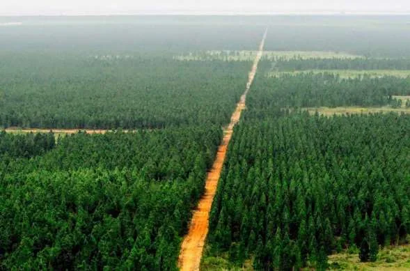
The profile identifies Macapaima, in the Mamo parish of Independencia municipality, as a hub of timber activity, with private sawmills, storage yards, warehouses and heavy machinery, and describes the progress of a pulp and paper mill. These figures must be confirmed with the operator before being used as installed capacity or actual output. The proposal is to evolve from an industrial activity hub into an integrated industrial ecosystem.
Explore the territory on the map
Public layers with source and date, and projects whose location has already been verified.